Showing posts with label Appalachian Trail. Show all posts

Sunday, June 17, 2012

Appalachian Trail, Section One

While Lee was out eating cheeseburgers, rescuing Beagles, and seeing some amazing sights, I wasn't feeling so hot. I got a ride from Standing Bear hostel to Hot Springs, NC to wait for Lee and hopefully start to feel better. He made it in good time, covering the 33 miles to arrive around 1 pm on the second day. I wasn't feeling any better, even after sleeping for hours and hours (and hours). I got a ride to Erwin, TN, the next logical town, and waited there for Lee again, this time 67 miles away and with a pile of books from the Hot Springs library book sale. We figured I could always come back in the fall to pick up those missing miles, and if Lee kept going until I could continue, we still had a chance of finishing.

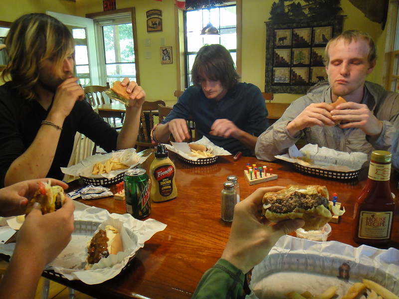
 $2.50 breakfast in Erwin, $1.39 for the biscuits and gravy plus an additional egg and sausage (Lee: I was not brave enough to eat this, picture of another hiker's food)

When he made it to Erwin, I was feeling a lot better, though not great, so we slackpacked for a day. Slackpacking is when you either have your pack sent on ahead or you get a ride up the trail and walk back, with only the water, extra layers, and snacks you should need for however many miles/hours you will be out instead of your whole pack. This is a great system when you want to make a lot of miles in a day or want to take it easy but still get some miles in. I still wasn't feeling as good as I'd hoped, but I really wanted to keep going forward on the Trail.

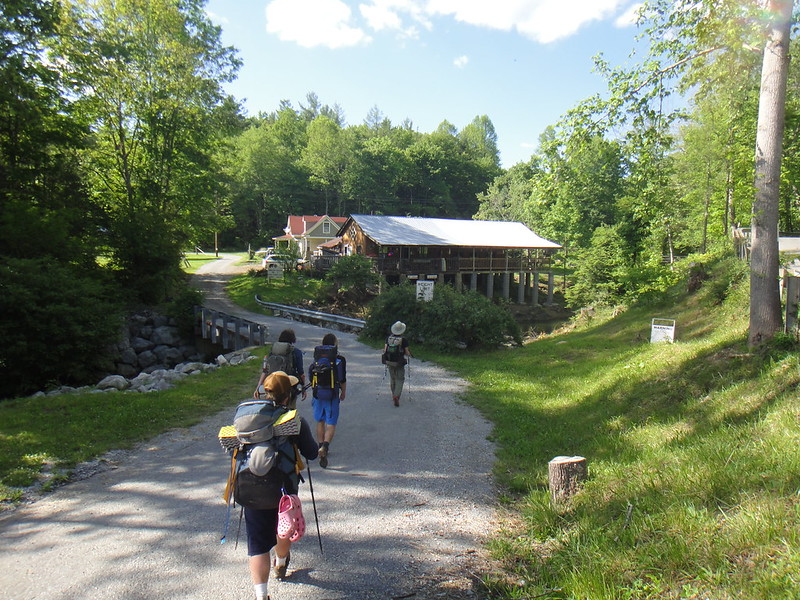
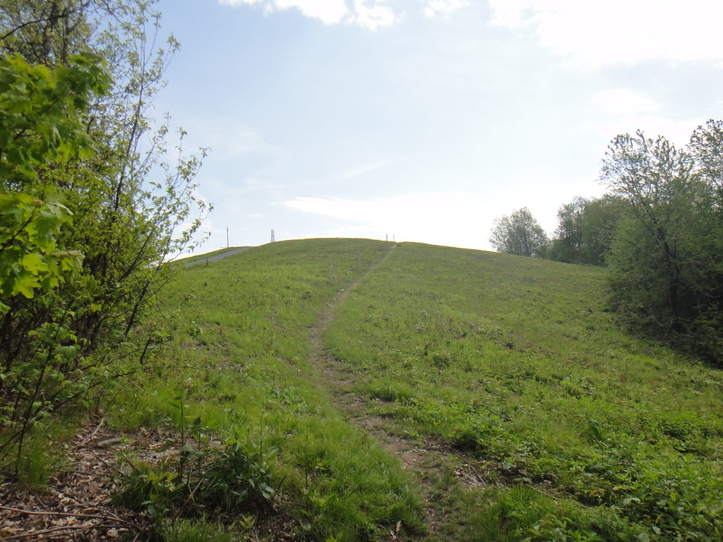
Slackpacking - we borrowed small packs from the hostel for the day to carry the necessities

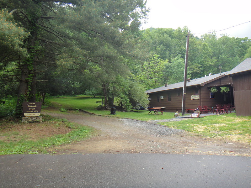
We took off the next morning from Uncle Johnny's hostel in Erwin towards the Greasy Creek Friendly, a hostel 16 miles away (after our slackpacking was accounted for). I realized a couple miles into the trek that this was not working and that it was my last day on the Trail for a while, probably for the entire summer. I felt like I'd been hit by a truck, no way was this from low iron, and I was feeling slightly feverish (again). We made it to a road about 4 miles from the hostel when it started to rain and at the rate I was going, there was no way we'd make it to the hostel before dark. We hitched a ride in the back of a pickup and he took us all the way to the hostel, a big help for me. Hitching is a lot easier when there's a female around; no cars stopped for Lee, who went on ahead to the road to look for a ride, but the first car that passed stopped when I was there even though I wasn't trying to catch their attention.


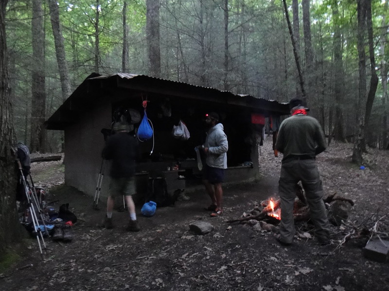
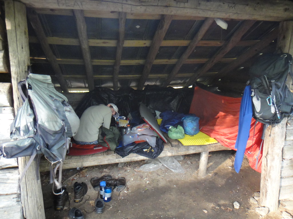
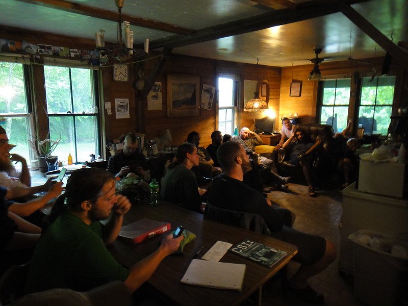
Greasy Creek was packed with hikers (the owner said it was a record), everyone trying to make it to Damascus for the following weekend for Trail Days or at least as far as they could get before finding a ride in. We were on the floor the first night due to the 21 other hikers who got there before us. Greasy Creek Friendly had a TV plus DVD/VHS player and a large selection of videos/DVDs for hikers coming through, so there was entertainment, and hot food was imported from a local restaurant.


Lee considered continuing on with the AT, since he pretty much had his trail legs by then and was easily doing 20 mile days. He decided that while finishing would be great, there was no guarantee he'd finish and since we started together, he wanted us to finish (or not) together, which ended our 2012 Thru-Hike attempt, because even if I felt better in a few weeks the schedule would be shot.


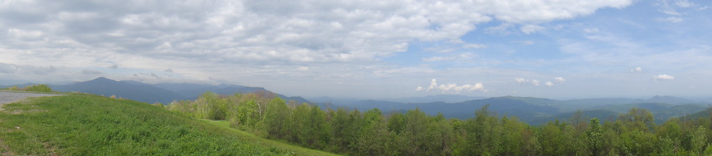
My symptoms were similar to Lyme's Disease, so we went to Johnson City to get tested. The following weekend was Trail Days in Damascus, Virginia, a place where past, present, and future 2000-milers join up and have a parade, a talent show, and a huge marketplace for gear where companies show off next year's models. I was feeling a bit worse, and staying in our tent in a huge field surrounded by the hikers who would be continuing when we wouldn't be just didn't sound like a fun time. We stayed at the hostel for a few days and then rented a car to drive the 14 hours to NH, the cheapest and fastest option for getting home.

Pretty good barbecue in TN to fuel us for the long trip ahead

As it turns out, I didn't have Lyme's, and a few days after getting from New Hampshire to Indiana to start setting up our new house, Lee got quite sick with all the same symptoms that I had and a higher fever.  I think it is safe to say that whatever this is, it is a disease and it is contagious - probably a virus (Lee: whatever this is sucks, and it doesn't go away quickly). My deepest, most sincere apologies to any hikers I may have accidentally infected! On the plus side, we can now set up our house and hopefully get some of the planned renovations in before classes start and things get crazy, even if we're not finishing the Trail due to illness.  We have plenty to do and this will make our fall a LOT easier.

Now we may be AT Section Hikers (walking the Trail over multiple years), or we may try for a Thru-Hike some other year if we have the opportunity to do so. Either way, we had a lot of fun, we learned a lot about extended backpacking (how to pack our stuff, what we actually want/use, what and when to eat for maximum performance, etc.), and we plan to go back again. We will finish it someday, but not this year.  The sorted and organized Flickr set is up, please see that for more pictures.

Friday, June 15, 2012

Hot Springs to Erwin

I walked out of Hot Springs bright and early, meeting up with a hiker named Slim who we'd run into a number of times before.  I did pretty much the whole first day with him, as talking makes the miles go faster.

Looking back down at Hot Springs

We had fairly glorious weather and made steady progress 


Towards the end of the day, Slim's hiking partner Jukebox and some hikers he was with caught up with us (Slim does early starts and steady walking, Jukebox sleeps in then runs) and we sped up to match their pace.  At a road crossing, we encountered a sign indicating that 0.7 miles along the road we could find a place that would sell us cheeseburgers.  The idea of cheeseburgers warred with the idea of walking an extra 1.5 miles that day, and cheeseburgers won.

 We did find the establishment, though we had to wait half an hour before the cook was ready to take orders even though we arrived inside of listed business hours.  Since there is only so much daylight and I had walking to do, this was less than stellar.


The wait was rewarded by large, juicy, inexpensive burgers.  I only had one because I knew if I ate two I wouldn't be able to keep walking, and would instead eat four and stay at that restaurant/hostel.  Trail hunger is a fearsome thing, and my body taught me that eating every 45 minutes or so while hiking was critical for being able to keep pace.  Town food is just a whole other story and I don't think I have ever eaten so much in single sittings as I have a few times on the AT.  I feel this pictures does a good job of illustrating hikers and food.  After my burger, I got back on the trail and did the four miles to the shelter that I'd been intending to go to, then ate dinner again.  The rest of the crew stayed and some of them ate more - I hadn't expected to see them again that day but they also made to the next shelter, though mostly in darkness.

The next morning took me up on to an extremely exposed ridgeline, so I was extra-glad that the weather was good.  The views were pretty solid as well, do check the Flickr set for more of them.


When I encountered this sign, I must admit I wondered "But WHEN are you planning on setting fire to the forest I am currently in?  'Cause that's sort of important!"


The major adventure of the second day was the beagle encounter.  I was walking along the trail, minding my own business, when a beagle walking the other direction along the trail plopped down at my feet and looked at me, clearly communicating "I need a human to solve my problems, and I have chosen you."  I'd run into a very 'country' gentleman in camo on an ATV earlier in the day who had lost some fox hunting dogs while fox hunting, and I figured this was probably one of those.  Of course, the place that I had seen that guy was at least 12 miles back from where I was.  

 That's my food-bag cord and carabiner as makeshift leash

I offered the dog water, which it didn't want, which was good because I didn't have that much with me for sharing.  There was a phone number on the collar, so I waited for hikers behind me to catch up, borrowed a phone, and called the number, which went directly to voicemail, probably because that guy was still up in the mountains looking for his dogs.  I couldn't stay where I was (no water there) and I was unwilling to abandon a dog that had clearly asked me for help, so I tried walking it down the trail with me.  The dog was not going anywhere - too tired to move more than a few dozen feet.  I picked up the dog and carried it the mile or so down to Rice Gap (I'd left a message on the phone saying I would try to get the dog there, being accessible and the nearest landmark) and allow me to inform you that 1) the dog was heavy, and I was carrying it in addition to my normal load and 2) the dog did not smell good and very shortly neither did I.  At Rice Gap, I put my bag down hoping that no bears would eat it, and took side trips down the dirt road looking for anything that looked like civilization, where I would be able to turn the dog over to someone with a phone and so forth.  I didn't find anything, but while I was looking I believe the guy on the ATV came into the area, because I heard shouting and horns blowing and someone obviously trying to make a ruckus, and the dog took off in that direction.  I'm not positive if I helped or hindered that process, but I'm pretty sure the dog made it home.  I still had two uphill miles to walk to the shelter, which thankfully wasn't full so I didn't have to set up the tent in the gathering dark.

The next day took me across Big Bald, which is supposed to be another place for outstanding views, but it was in a cloud when I crossed it and everything was pretty much gray. 

 I meant to get a picture of the Bald Mtn Shelter, because it was one of the nicest I'd seen, but I forgot.  I did take a picture of myself going to get water at that shelter, with my sweet hat and scrufftastic trail beard.

The shelter that night was very full, but I still had a spot.  There were some weekend hikers there and they built an enormous fire, which was a little annoying because the pit was much too close to the shelter and the smoke blew inside.  This was made up for when Two Men and a Dog and Phoenix (other thru-hikers) rolled into camp late and cooked hot dogs over it.  They had way too many so I got three hotdogs with buns and mustard to supplement my regular dinner with, and I didn't have to pay for them or carry them to the camp.  Trail magic!

 It was only 7 miles in to Erwin the next morning, and I left early and hustled because rain was threatening.  I just beat the rain to the hostel and was well pleased to not get soaked.  Once again, the hostel was right on the trail and Ana was there waiting.

Wednesday, June 13, 2012

Standing Bear to Hot Springs

Without Ana to moderate my pace, I attacked the mountains with foolish vigor.  Her keeping of a reasonable pace was definitely the smart thing when we were together, but had meant that I never really opened the taps and pushed myself hard.  In the first four hours on my own, I did ten miles, carrying close to 40 pounds, and across a section with more than 4000 feet of climb.  If you're not up on your distances and weights, that is a pretty beefy walk.  Felt outstanding as I bounded over obstacles, sweeping other hikers into my dust.
 
Approaching the Summit to Snowbird Mountain, half a mile vertically above the hostel

Snowbird Mountain had stunning views - possibly the best on the trail to date.  I highly recommend checking the Flickr set to see some of these panorama shots in larger sizes.  I stopped there for 20 minutes or so and had a snack so I could enjoy the views for longer.

After Snowbird, the terrain dives down to make room for the next big up-a-mountain stretch, which climbs to Max Patch.  Now, in the guidebook, it lists Max Patch as having scenic views, but it lists that for a lot of places.  What Max Patch actually has is the best views in at least the first 375 miles of the AT by a meaningful margin, in my book.  I thought Snowbird was something special, but Max Patch just clobbered me.  360 degrees of green mountains and nothing else.  I really wish it had been a reasonable place to stop for the night, so I could have stayed for several hours, but I had to settle for another snack and a lot of pictures before moving on.

Max Patch itself

One of the views from it


After the four-hour speed binge, I realized I probably needed to turn it down a couple of notches so as to not die, and since I'd already done 90% of the hills for the day, I could still make good time on the flats while putting in less effort.  Since I'd had to split the gear with Ana in haste for her early-morning departure, the job wasn't particularly cleanly done and I'd given her the tent to make up for some of the other extra weight I was carrying.  Given the distance to Hot Springs, I would only need to stay in a shelter for one night and we hadn't encountered a completely full shelter in some time - it was a risk, but not a particularly stupid one.

Around 5 in the afternoon, it started to look like a storm, and I was close to an empty shelter and ducked into it to avoid the downpour.  It seemed to slow after about an hour, and I wanted to get to the next shelter which was only five miles and a 900 foot climb away, so I headed out in a lull.  I got rained on pretty well after that, but I did make the shelter, which proved to be one person short of full, which was very lucky for me as my backup plan would have been to walk either 5 miles back to the first shelter or the additional 13 miles to town, at least the second half of which would have been in the dark with my headlamp.

 The shelter is in the book as a 6-man, but five men and a dog (not shown) was definitely the limit.  Also, since people are taller than they were when the shelter was built in 1938, it was impossible to get both feet and head on the sleeping platform at the same time.  

The shelter was up quite high and the wind was blowing so it was cold up there, but well within the abilities of my gear - I put on almost everything but I was toasty warm all night long.  A mouse did run across my bag towards morning, but nothing of mine got gnawed on so that was OK.

The next morning I had an easy 13 mile downhill jaunt to Hot Springs, where I found Ana at the conveniently located hostel.


National Forest on the left, hostel on the right - it is pretty much on the path

As a matter of fact, pretty much the whole town of Hot Springs is on the AT, and they mark the path down the main street with signs in the sidewalk and along the road.

The two-day rest that was supposed to get Ana fully rested to get back on the trail was not successful, and she was feeling much worse than she had two days ago.  I took a zero day and the awesome hostel staff gave us a free ride to a clinic 30 miles away to get her tested for mono, which she didn't have.  Her bloodwork also showed normal iron.  So, we were a bit confused and decided to give her another several days off to see if she got better or worse.  I'd walk the 67 miles to Irwin, the next town, and meet her there.

Monday, June 11, 2012

Gatlinburg to Standing Bear

It's been a while between posts - that will get explained in the course of all these make-up posts.

Leaving Gatlinburg, we figured we were in good shape.  Ana had had low iron, but we had iron pills, and therefore we'd just take it easy for a few days and we'd be rolling.  The first day we started back at Clingman's Dome, walked down to Newfound Gap and then three miles back up to Icewater Creek Shelter.  The twelve miles were not easy for Ana, but weren't nearly as bad as before either - please remember that she walks in front to set the pace and mileage and don't send me emails about being a slave driver, thanks.

 View from the shelter

One cool thing about the second half of the Smokies is that the trail runs the ridgeline of the range.  Sometimes the ridgeline is basically the path with very steep dropoffs on either side, which gives great views.  It was almost never narrow enough to be worrisome.  We did another 12 miles the next day, and Ana still felt mediocre.

Those sides go down a looong way

 Not so mediocre as to pass up an opportunity to pet moss.  She said "It looks fuzzy".


 The third day we had great weather and Ana was feeling better, so we pushed for a hostel, which was about 19 miles away, but almost entirely downhill.


 We made it with daylight to spare and found the hostel, named Standing Bear, something of a wonderland for hikers.  They had a store on-premises stocked with everything a hiker could want for supplies and pretty much nothing else.

We ate freezer pizza and I doubled up entrees by also eating I think a pound of quinoa & rice mix.  Ana felt OK that day but not great, and the plan was for her to get off-trail for a few days to make sure she was ready to continue, meeting me further up the road in Hot Springs.  She found a free ride from a non-hiker who was going that way and left super-early the next morning, while I headed up into the mountains.


Saturday, May 5, 2012

Fontana Dam to Gatlinburg

Fontana Dam is a pretty serious piece of work, and the AT runs directly across the top of it.  After our stop at the Hike Inn, we got dropped off back on the trail a mile or so before the dam and headed out across it.

Across the dam we cross from the Nantahala National Forest to the Great Smoky Mountains National Park, which has slightly different rules and bigger mountains.

 The Smokies have been having problems with bears, and we can verify personally that they are not afraid of people and they are right, right on the trail.  We saw four bears in the first two days.  Guys in one of the shelters started calling Ana "Bear Magnet" because most people hadn't seen any.  We were much, much closer on several occasions but in those instances pictures were not a priority - getting the hell away from the bear was.  When we blog in more detail later we'll probably do an entry on bears in the Smokies, but the bottom line is that while we were closer than we may have liked, we never had a serious problem.  The black dot in the middle is probably the mama bear - the cub is in the bushes somewhere.

 Scarier than the bears, at least for the first few seconds, was our encounter with this large rattlesnake.  It was laying across the path and blended in with the roots and shadows.  Ana, who was walking in front, didn't see it until we entered the threat radius and it started rattling.  We both knew the sound immediately, though we'd never heard it before.  Luckily, the snake was cold and not very active, and we weren't too too close, so we just backed up and it decided to leave the trail.

 That's the kind of thing to make you stare at all future roots and shadows just a little bit harder.

 Shelters in the Smokies are mandatory due to bear activity these days, so they were pretty full but there was always enough room.  We ran into some pretty cool folks section hiking up there and actually had a pretty good time hanging out in the evening.  There was some serious snoring - need to get some earplugs before heading out of town for future instances.

 We've had excellent weather pretty much all through the Smokies so far, have about another 30 miles to the edge of the park.

 The Smokies actually have the highest single point on the AT, and most of the overall range is above 5000 feet. If the weather was crappy we'd have had to be really careful about lightning and cold.  Luckily, we were more worried about trying to get good pictures because we had excellent weather.  The terrain varied between pretty tough and quite easy, so not so bad overall.


Thunderhead Mountain is something of a mental milestone for 2012 (the trail changes slightly each year) as the peak is the point where you become less than 2,000 miles from the end.

1999.9 ...miles to go...from that point, we're a few days beyond that now.

 Better view of the kind of shelter we get each night if we're lucky.  The pre-setup cables for hanging food bags save so much work and trouble, I love them dearly.

 Large turkey serenaded the camp one morning.

 We've seen deer several times - they're obviously not hunted because they are completely unafraid.

 Wild boar are apparently all over the Smokies, frequently see areas where they have rooted.  Supposed to be extremely aggressive, thankfully nocturnal and generally hikers never see them.

 More good weather.


 Getting close to Clingman's Dome, the highest point on the AT, the forest changed from deciduous to coniferous.  We felt sort of like we had changed levels in a game or something.

 Tower on top of Clingman's built in the late 50's, hence the space-race architecture.  


 The trail actually straddles the state line for most of this part.  We bummed a ride into town for re-supply from the top of Clingman's, since that's one of two places a road crosses the Trail in the park.

 Gatlinburg is apparently a major tourist area, kind of board-walky and full of wild museums and stuff.  We hit the Grand Prix, the hiker motel (only $30 a night...impressive) and got some supplies and dinner.


 Didn't say no to free moonshine tastings here, can't say I'll be switching from scotch to moonshine anytime soon though.

 Ana had been feeling kind of in-general crappy and our mileage had been not-so-great for a few days as a result, so in town she went and got a blood test to check for low iron or other performance-reducing dietary deficiencies (we normally eat a lot better than we do on the trail, seemed plausible) and they found her blood iron at about 10% of the minimum acceptable value for blood donation. Vitamins, supplements, beef / beef jerky, and "better switch out the Pop Tarts for Clif Bars" were the recommended fix, so we headed to a serious steakhouse to get us both some iron.  She ordered and nearly finished a darn good 28oz porterhouse, so hopefully between that and the supplements we'll be killing it, rather than being killed by it, out on the trail tomorrow.


 She gnawed the bones for breakfast in a manner most befitting an individual who now pretty much lives outdoors.

You see some things in places in the south that you just don't see very often in the northeast - this is above the computer terminal at the hotel.  I was not the only hiker to take a picture.  The sign for the hotel has "Get right or get left" on it, which I presume refers to the Rapture.  I made friends with the owner and staff by fixing the guest computer, saving them the trouble of calling some expensive technician, but I have been careful not to comment on the extreme/comical levels of religious material distributed around the hotel, because I think things would get hostile pretty fast. DVDs about what to do if you're left behind, scriptures, lots of other things on the walls and tables.

As a final note, please don't expect blog entries this big very often - I got to use the heck out of the guest computer because I fixed it and no other guests wanted it, but it is pretty hard to get enough internet access and non-trail time (gotta make the miles, and then dining takes priority after that) to blog like this.  We will update the Google Map with the towns when we get to them, and sometimes that may be it.  

Also check the AT Flickr set, we're tossing pictures up there when we can.  To make things simpler, each time we upload some pictures I'll iterate the number in the file names, so the first upload (from Franklin) the files will all have names starting with 'AT', and the second time, here in Gatlinburg the names will have 'AT2', etc, mostly so I can keep track of what is uploaded, but it can also be used to see if we've added pictures since the last time.