Fontana Dam is a pretty serious piece of work, and the AT runs directly across the top of it. After our stop at the Hike Inn, we got dropped off back on the trail a mile or so before the dam and headed out across it.

Across the dam we cross from the Nantahala National Forest to the Great Smoky Mountains National Park, which has slightly different rules and bigger mountains.

The Smokies have been having problems with bears, and we can verify personally that they are not afraid of people and they are right, right on the trail. We saw four bears in the first two days. Guys in one of the shelters started calling Ana "Bear Magnet" because most people hadn't seen any. We were much, much closer on several occasions but in those instances pictures were not a priority - getting the hell away from the bear was. When we blog in more detail later we'll probably do an entry on bears in the Smokies, but the bottom line is that while we were closer than we may have liked, we never had a serious problem. The black dot in the middle is probably the mama bear - the cub is in the bushes somewhere.

Scarier than the bears, at least for the first few seconds, was our encounter with this large rattlesnake. It was laying across the path and blended in with the roots and shadows. Ana, who was walking in front, didn't see it until we entered the threat radius and it started rattling. We both knew the sound immediately, though we'd never heard it before. Luckily, the snake was cold and not very active, and we weren't too too close, so we just backed up and it decided to leave the trail.

That's the kind of thing to make you stare at all future roots and shadows just a little bit harder.

Shelters in the Smokies are mandatory due to bear activity these days, so they were pretty full but there was always enough room. We ran into some pretty cool folks section hiking up there and actually had a pretty good time hanging out in the evening. There was some serious snoring - need to get some earplugs before heading out of town for future instances.

We've had excellent weather pretty much all through the Smokies so far, have about another 30 miles to the edge of the park.

The Smokies actually have the highest single point on the AT, and most of the overall range is above 5000 feet. If the weather was crappy we'd have had to be really careful about lightning and cold. Luckily, we were more worried about trying to get good pictures because we had excellent weather. The terrain varied between pretty tough and quite easy, so not so bad overall.


Thunderhead Mountain is something of a mental milestone for 2012 (the trail changes slightly each year) as the peak is the point where you become less than 2,000 miles from the end.

1999.9 ...miles to go...from that point, we're a few days beyond that now.

Better view of the kind of shelter we get each night if we're lucky. The pre-setup cables for hanging food bags save so much work and trouble, I love them dearly.

Large turkey serenaded the camp one morning.

We've seen deer several times - they're obviously not hunted because they are completely unafraid.

Wild boar are apparently all over the Smokies, frequently see areas where they have rooted. Supposed to be extremely aggressive, thankfully nocturnal and generally hikers never see them.

More good weather.


Getting close to Clingman's Dome, the highest point on the AT, the forest changed from deciduous to coniferous. We felt sort of like we had changed levels in a game or something.

Tower on top of Clingman's built in the late 50's, hence the space-race architecture.


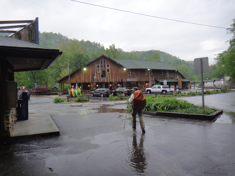
The trail actually straddles the state line for most of this part. We bummed a ride into town for re-supply from the top of Clingman's, since that's one of two places a road crosses the Trail in the park.

Gatlinburg is apparently a major tourist area, kind of board-walky and full of wild museums and stuff. We hit the Grand Prix, the hiker motel (only $30 a night...impressive) and got some supplies and dinner.


Didn't say no to free moonshine tastings here, can't say I'll be switching from scotch to moonshine anytime soon though.

Ana had been feeling kind of in-general crappy and our mileage had been not-so-great for a few days as a result, so in town she went and got a blood test to check for low iron or other performance-reducing dietary deficiencies (we normally eat a lot better than we do on the trail, seemed plausible) and they found her blood iron at about 10% of the minimum acceptable value for blood donation. Vitamins, supplements, beef / beef jerky, and "better switch out the Pop Tarts for Clif Bars" were the recommended fix, so we headed to a serious steakhouse to get us both some iron. She ordered and nearly finished a darn good 28oz porterhouse, so hopefully between that and the supplements we'll be killing it, rather than being killed by it, out on the trail tomorrow.


She gnawed the bones for breakfast in a manner most befitting an individual who now pretty much lives outdoors.

You see some things in places in the south that you just don't see very often in the northeast - this is above the computer terminal at the hotel. I was not the only hiker to take a picture. The sign for the hotel has "Get right or get left" on it, which I presume refers to the Rapture. I made friends with the owner and staff by fixing the guest computer, saving them the trouble of calling some expensive technician, but I have been careful not to comment on the extreme/comical levels of religious material distributed around the hotel, because I think things would get hostile pretty fast. DVDs about what to do if you're left behind, scriptures, lots of other things on the walls and tables.
As a final note, please don't expect blog entries this big very often - I got to use the heck out of the guest computer because I fixed it and no other guests wanted it, but it is pretty hard to get enough internet access and non-trail time (gotta make the miles, and then dining takes priority after that) to blog like this. We will update the Google Map with the towns when we get to them, and sometimes that may be it.
Also check the AT Flickr set, we're tossing pictures up there when we can. To make things simpler, each time we upload some pictures I'll iterate the number in the file names, so the first upload (from Franklin) the files will all have names starting with 'AT', and the second time, here in Gatlinburg the names will have 'AT2', etc, mostly so I can keep track of what is uploaded, but it can also be used to see if we've added pictures since the last time.